GPS position data can be imported for boreholes using Sense Cloud.
-
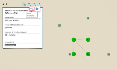
Go to Plan view . Click the GPS import icon under the import icon.
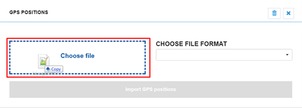
 An import window opens with a file drop area and a dropdown menu for choosing the file format.
 -
Drag and drop or choose a file into the file drop area.
-
Choose the file format (or source system) of the file, and click the Import GPS positions button.
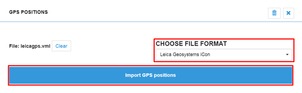
At the moment, the GPS import feature accepts four different file formats: Leica Geosystems iCon, Leica Rover, Sandvik SanRemo, and Atlas Copco Surface Manager. Leica Geosystems iCon and Sandvik SanRemo files use strict timestamp matching, and Atlas Copco Surface Manager uses name matching. Leica Rover uses time order matching.
Note: Imported GPS positions can be deleted from the same import window using the trashcan icon.
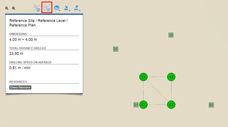
If there are no errors in the imported file, the window closes. A new icon becomes available on the toolbar for toggling between the previous local positions and the imported GPS positions. Clicking the toggle button will show the GPS positions of the holes on the plan. Plan dimensions also update based on the toggled mode.
Note: If you try to import more positions on a Plan which already has GPS data, you will be prompted if the old data should be overwritten.